4(b) What is a Yazoo stream? Why are Yazoo basins the areas of repeated flooding? Give examples of Yazoo stream/areas from various parts of the world.15 Marks (PYQ/2024)
Answer:
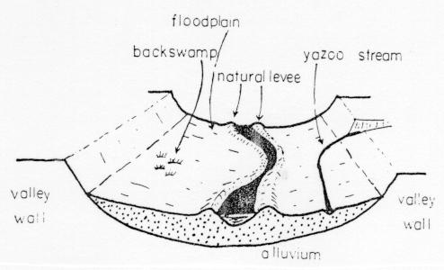
What Is a Yazoo Stream?
A Yazoo stream is a tributary that, instead of joining a major river directly, is forced to flow parallel to the river’s course for a considerable distance. This phenomenon occurs because natural levees—raised embankments formed by sediment deposition from the main river—act as barriers that prevent the tributary from flowing directly into the river. The term “Yazoo” originates from the Yazoo River in Mississippi, where this fluvial behavior was first recognized.
Why Are Yazoo Basins Areas of Repeated Flooding?
Yazoo basins are regions adjacent to these parallel-flowing streams that experience persistent flooding due to several interconnected factors:
- Natural Levee Formation: The main river deposits heavy sediments that build up natural levees. These elevated ridges divert the tributary into a parallel pathway, effectively isolating it from the main river’s direct drainage.
- Low-Lying Floodplains: The areas between the main river and the Yazoo stream (the Yazoo basin) are typically flat and low-lying. Such topography hinders water runoff, allowing water to remain on the surface, especially during peak flow periods.
- Backwater Effects and Overflow: During periods of high discharge—such as during heavy rains or snowmelt—the water in both the main river and the Yazoo stream may overflow their banks. The proximity of these channels amplifies backwater effects, which further increase the likelihood of inundation.
- Sediment Accumulation: Continuous sediment deposition can clog natural drainage pathways, reducing the basin’s capacity to discharge water effectively and leading to recurrent flooding events.
Examples of Yazoo Streams and Similar Areas Worldwide
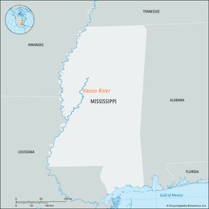
- United States (Mississippi River System): The Yazoo River in Mississippi is the classic example. This stream flows parallel to the Mississippi River for many miles because of the natural levees along its banks, and its adjacent floodplain frequently experiences inundation during high-flow events.
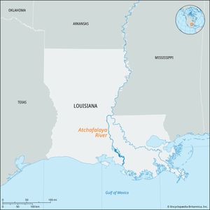
- Atchafalaya Basin, Louisiana: While not labeled “Yazoo” per se, the Atchafalaya River in Louisiana exhibits similar fluvial dynamics. Multiple channels run parallel and interact with vast, low-lying floodplains that undergo significant flooding.
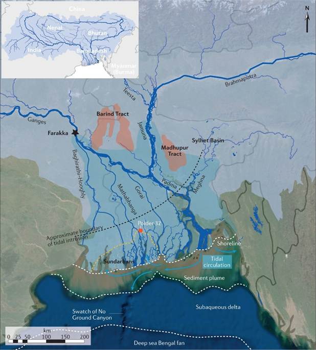
- Ganges Delta, India/Bangladesh: In the expansive alluvial plains of the Ganges Delta, several distributaries are forced to follow paths parallel to the main river due to natural levee development. These channels, sharing Yazoo-like characteristics, result in widespread seasonal flooding during the monsoon.
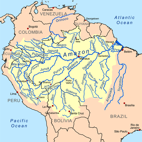
- Amazon Basin, Brazil: Portions of the Amazon Basin display similar behavior. Here, tributaries confined by natural levees and sediment-rich deposits lead to the formation of flood-prone areas within the vast Amazon floodplain.
- Danube Delta, Europe: Some channels within the Danube Delta exhibit features comparable to Yazoo streams where levee dynamics alter the flow, causing recurrent flooding in adjacent low-lying regions.
Conclusion
In essence, Yazoo streams are a distinctive consequence of fluvial processes where natural levees force tributaries into parallel courses alongside major rivers. The adjacent Yazoo basins, characterized by low topography and sediment accumulation, are especially vulnerable to repeated flooding. This phenomenon is observable in diverse regions—from the Mississippi and Atchafalaya basins in the United States to parts of the Ganges Delta, Amazon Basin, and Danube Delta—illustrating its global significance in fluvial geomorphology and flood management.